GTP for MapInfo® Vertical Mapper™ opens all the functionalities of MapInfo® Vertical Mapper™ to more than 60 raster formats including the formats of the major GIS and Imaging industry products: ArcGIS, PCI, Erdas, Idrisi and Surfer.
GTP for MapInfo® Vertical Mapper™ is built with Vertical Mapper users in mind to allow them leverage their investment on MapInfo® Vertical Mapper™ product and take advantage of the increasingly available data.
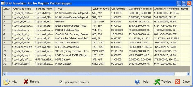
Whether you have a raster dataset produced by ArcInfo, Idrisi, PCI, Erdas, Geosoft or ENVI, a satellite image (SPOT, Radar, NOAA, NITF), a nautical chart (BSB), a bitmap image (GIF, Bitmap, Jpeg, PixMap), or a DEM (SRTM, SDTS, USGS DEM, GTOPO30, DTED); GTP for MapInfo® Vertical Mapper™ will bring these data to Vertical Mapper native format with few clicks.
Comments